Manual
Login
Our 3D CAD supplier models have been moved to 3Dfindit.com, the new visual search engine for 3D CAD, CAE & BIM models.
You can log in there with your existing account of this site.
The content remains free of charge.

Top Links
Manual
 |
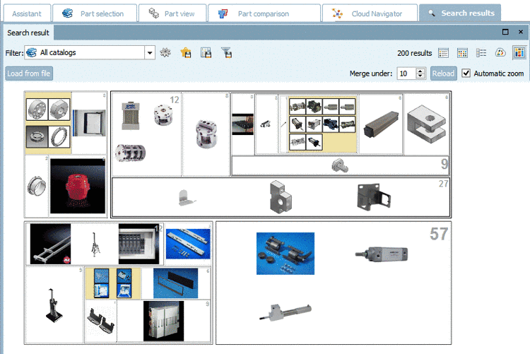
In the mode
 Partition Map the
results are partitioned in rectangles.
Partition Map the
results are partitioned in rectangles.
At first the main level is displayed, always four cluster with four representatives each. So you have 16 options. When clicking on a cluster you see further images and automatically zoom in, step by step down to the lowest level with parts. In each cluster the number of contained results is displayed in the top right corner.
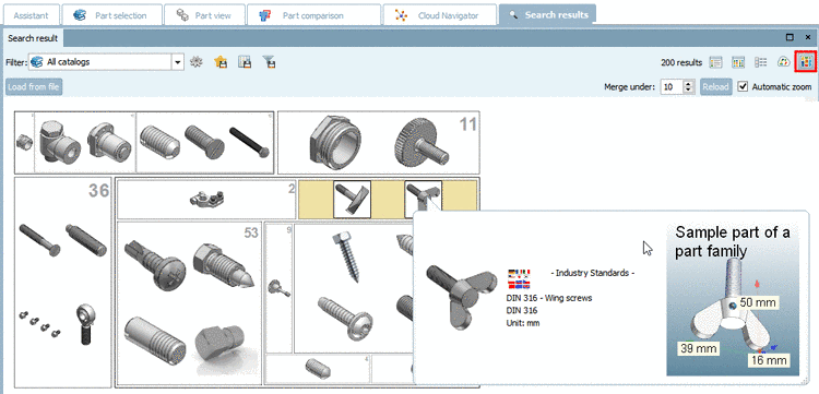
On the lowest level, in the "Partition Map" as well, you can call up the 3D view via mouseover or open the part in the "Part view" via context menu command as usual.
![[Note]](/community/externals/manuals/%24%7Bb2b:MANUALPATH/images/note.png) |
Note |
|---|---|
An inactive (grayed out) command shows that the special index has not yet been created. See Section 1.3.8.6.2, “Context menu commands in detail ” in PARTsolutions / PARTcommunity4Enterprise - Administration Manual -> Geometrical search index -> Create partition map. | |
